Editor’s Note: This post is written by a member of LTV’s sponsored content team, The Leisure Explorers. Do you own a Leisure Travel Van and enjoy writing? Learn more about joining the team.
In Part One of our journey, we travelled from home to Winnipeg, then in Part Two, we travelled from Winnipeg to Moose Jaw and returned.
Now, in Part Three, we will travel from Winnipeg back home with our 10th journey along the Lake Superior north shore. Our destination for the first night was Aaron Provincial Park, located just east of Dryden, Ontario, which we had visited before.
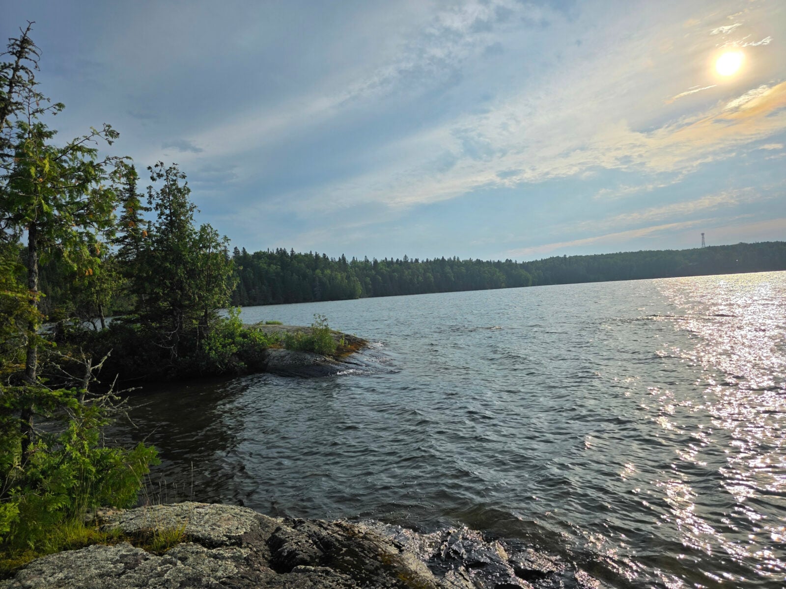
Our electric site was quite large and very separate from any neighbours. After we set up, we did a hike out to the peninsula point and then hiked on the Cedar Trail loop. The campground was quite complete with a mix of seasonal and overnight campers. The views of the lake and islands, the calls of the loons, and the partially setting sun were quite lovely.
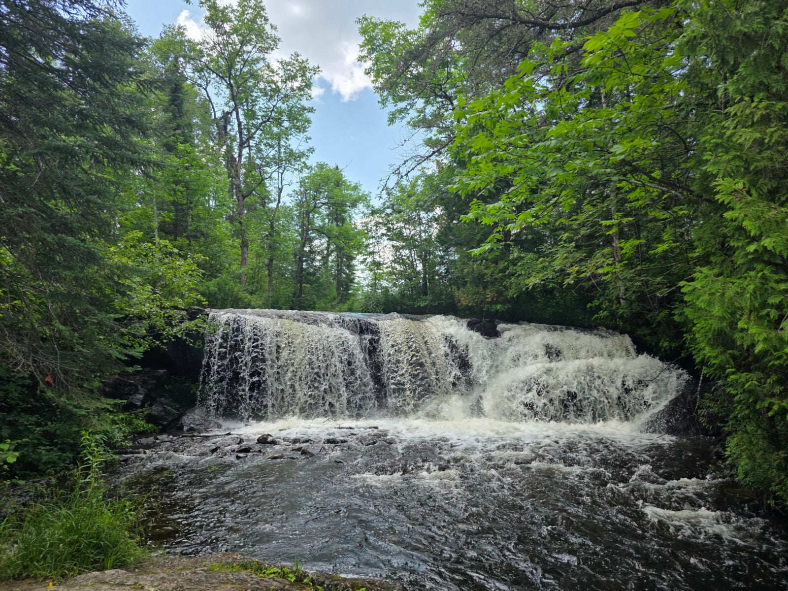
The next day, we tried another new stop for us, a picnic area called Raleigh Falls, located east of Ignace. A small but beautiful cascade with a fast-moving river and apparently a good spot for fishing. Then we had lunch at a picturesque location along the tannin-colored Lodge Lake.
Our destination that evening was past Thunder Bay in Dorian, where there was a Harvest Host location called Canyon Country Coop. The description said they had a grill shack that served burgers, so that is what we had planned for dinner. However, when we got there, it was closed for the day as the cook had an appointment, so we had to get creative with some leftovers.
We parked at the far back of the lot behind a large Class A motorhome, and the Trans Canada Highway noise was really not that bad for the night. Since the general store also had a liquor store, I was able to buy several local beers I hadn’t tried before from Sleeping Giant Brewery.
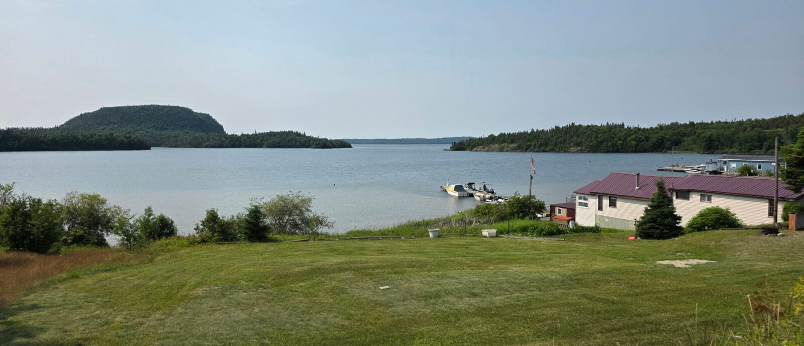
Our first stop the next day was the little village of Rossport, as they had a park along the water with a Group of Seven easel. Rossport is the site of one of the finest harbours on the north shore of Lake Superior due to the offshore islands that protect it from the large waves Lake Superior can generate. Here are some fun facts about Lake Superior:
- Lake Superior holds 10% of the Earth’s surface freshwater—enough to fill all the other Great Lakes plus three more Lake Eries.
- Lake Superior was created when glacial meltwater filled a billion-year-old volcanic basin 10,000 years ago.
- A drop of water takes almost 2 centuries to circulate in Superior before exiting the lake’s only natural outflow, which is the St. Mary’s River in Sault Ste. Marie.
- Climate change has been warming Lake Superior by 1 degree every decade since 1980.
- Lake Superior contains three quadrillion gallons of freshwater—enough to cover the North and South American continents in 1 foot of water.
In the park, we saw some signboards about the Lake Superior Water Trail, which covers 1,000 kilometers. Just after reading the board, we saw two people launch their ocean-style kayaks to go on a day trip.
Sharon had read about a highly rated restaurant called Serendipity Gardens Café that was scheduled to open at noon, so we decided to hang around and go there for lunch.
It turned out that the chef was late that day, but the server kept us entertained with some local history and stories about life on Quarry Island, where she lived. The food was phenomenal. I had the baked Lake Superior trout, and Sharon had the smoked salmon sandwich with a side salad. For dessert, I had the luscious lemon cake, and Sharon had the mile-high chocolate cake. We will definitely return to this fantastic little restaurant if our timing works well to visit Rossport on a future trip. Sharon even said it doesn’t matter what time of day it is, she’s returning for the mile-high cake!
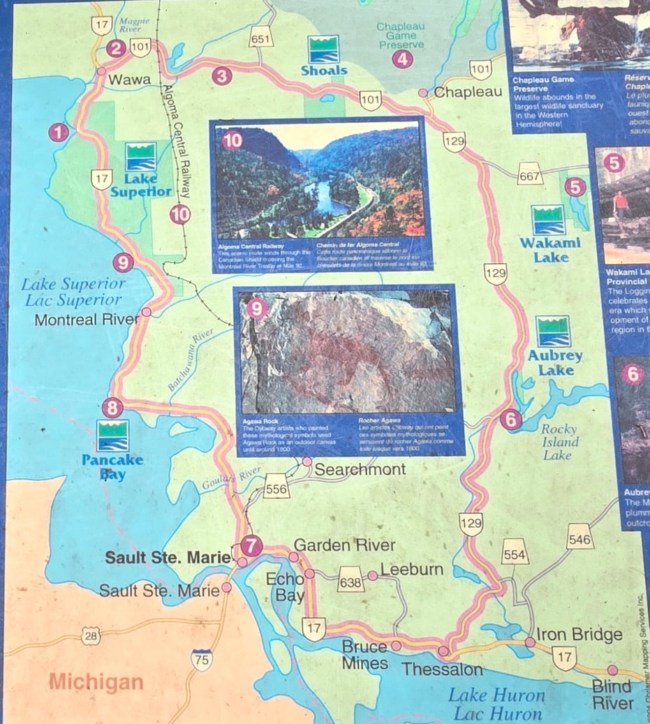
We continued from Rossport, and when we drove through Nipigon, we had a brief moment of panic. As you entered town, there was an electronic board that stated Highway 17, south of Wawa, had been closed to all traffic due to a road washout. Since that’s the main road we would usually drive, we decided to pull over and do some research.
One option was to turn Northeast after Nipigon and take Highway 11, but that would mean cancelling our booking for Thessalon, cancelling our ferry from South Baymouth to Tobermory, and driving a huge extra distance to get home. The second option we found was to turn off at Wawa and take Highway 101/129 to bypass the affected area. It was only an extra 35 kilometers to do this, and it would allow us to visit some more new places, so we decided to plan that option.
In the meantime, they managed to open one lane on Highway 17 later that day, but we decided to avoid any traffic congestion. The drive south from Nipigon was very light in traffic in both directions due to the closure. As we got closer to Wawa, I saw a mother and baby moose cross the highway, but it was too far away for Sharon to get a picture. Our destination for that night was a Harvest Host called Algoma Highlands Wild Blueberry Farm and Winery in Wawa. We were surprised when we arrived, as there were six other Harvest Host guests staying in the field by the building. This was the most campers we’ve ever seen at a Harvest Host location. We sampled the wine and purchased it, along with some other food products.
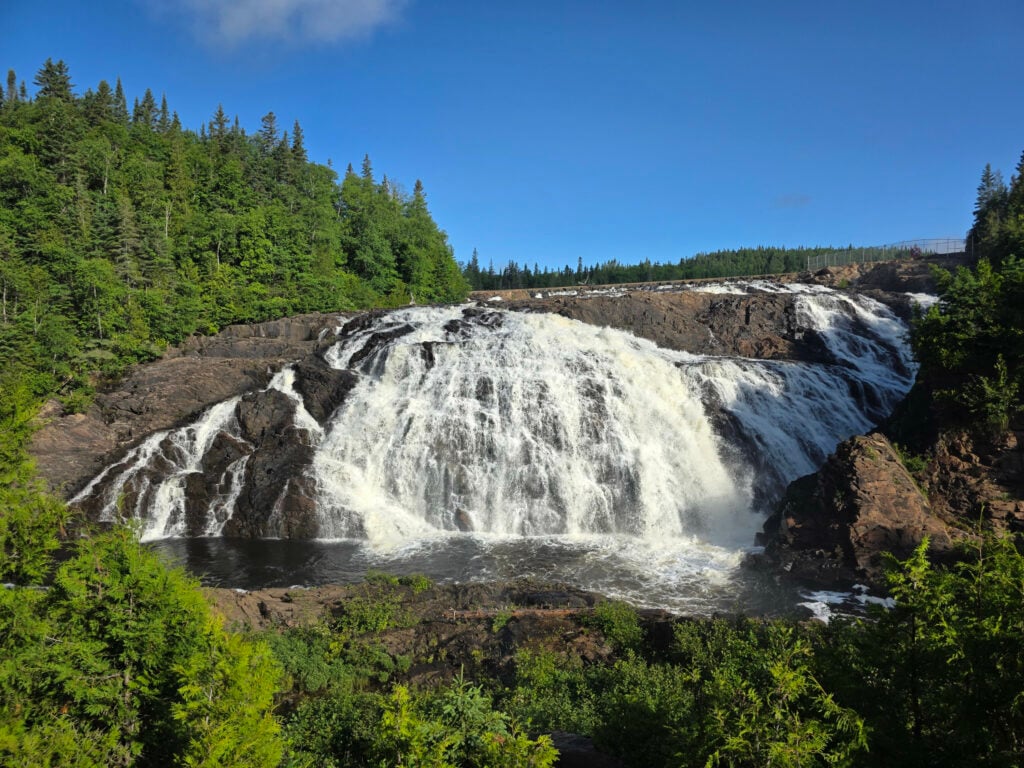
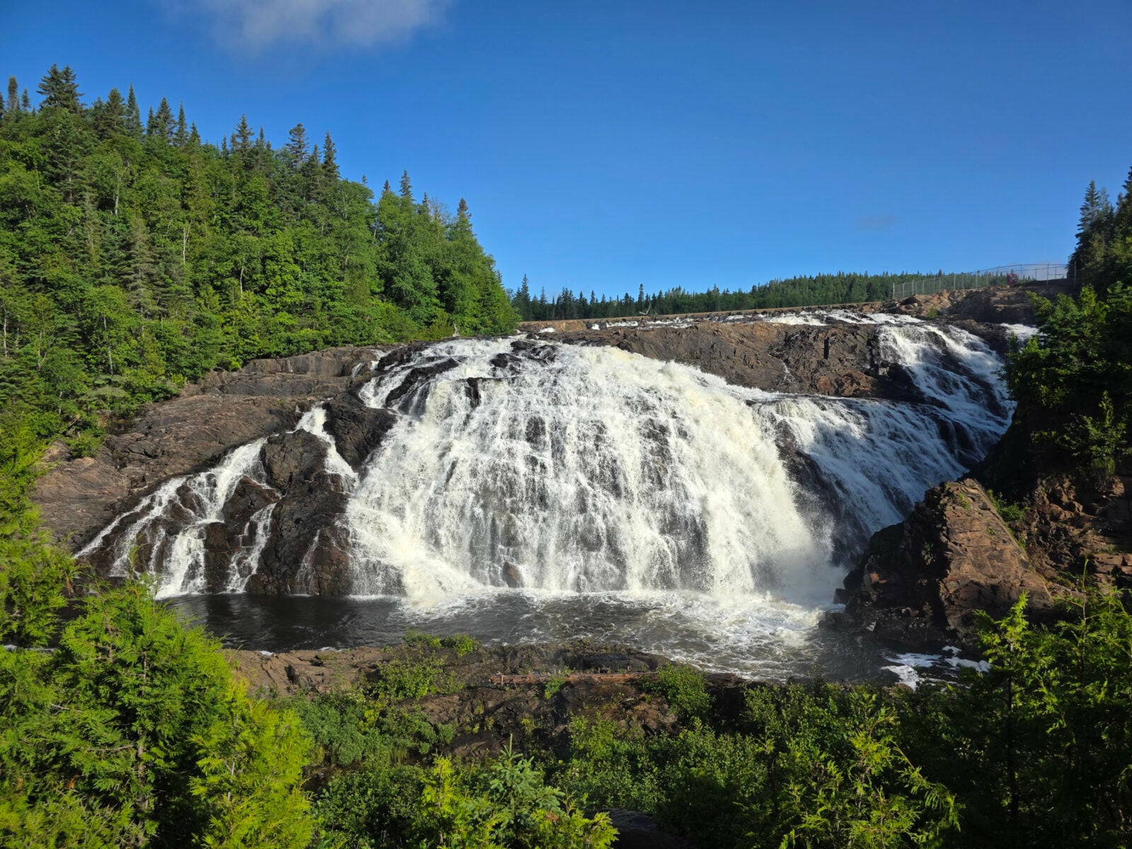
The next morning, it was sunny (after a night of rain), so we decided to take the really rough gravel washboard road to High Falls. Algoma Wild Blueberry Farms owned the road and fields to the falls. We saw several sandhill cranes feeding in the fields. We were the first to arrive at High Falls that day, and as the sunlight began to hit the falls, it was pretty picturesque. They had a display board about logging in the area and the dam construction to control water flow for logging. In addition, they had display boards about many prominent people from the Wawa area. One was about Glenn Gould, the iconic Canadian piano virtuoso who loved the North and made frequent trips to Wawa, always staying in the same hotel room at the Wawa Motor Inn.
We drove back through Wawa and saw all the Goose statues and then started on Highway 101 east. The road had cliffs, forests, and lakes, which reminded me a lot of the start of Highway 11 from Nipigon that we had taken on another trip. We saw a temporary sign that said emergency situation ahead, and when we rounded the bend, a worker stopped us and said we were ok to drive through as our lane was open. 2 huge tow trucks were pulling a Class A motorhome out of the ditch. The shoulders all along this road were very soft, so if you hit the shoulder, you would likely roll into the ditch. There were no ambulances or police cars, so we assume the driver was driving the road the night before, likely because this was a bypass for the Highway 17 closure, and got too close to the edge and crashed. The motorhome was totalled. After that scene, Sharon said she didn’t want to do any of the driving along this route.
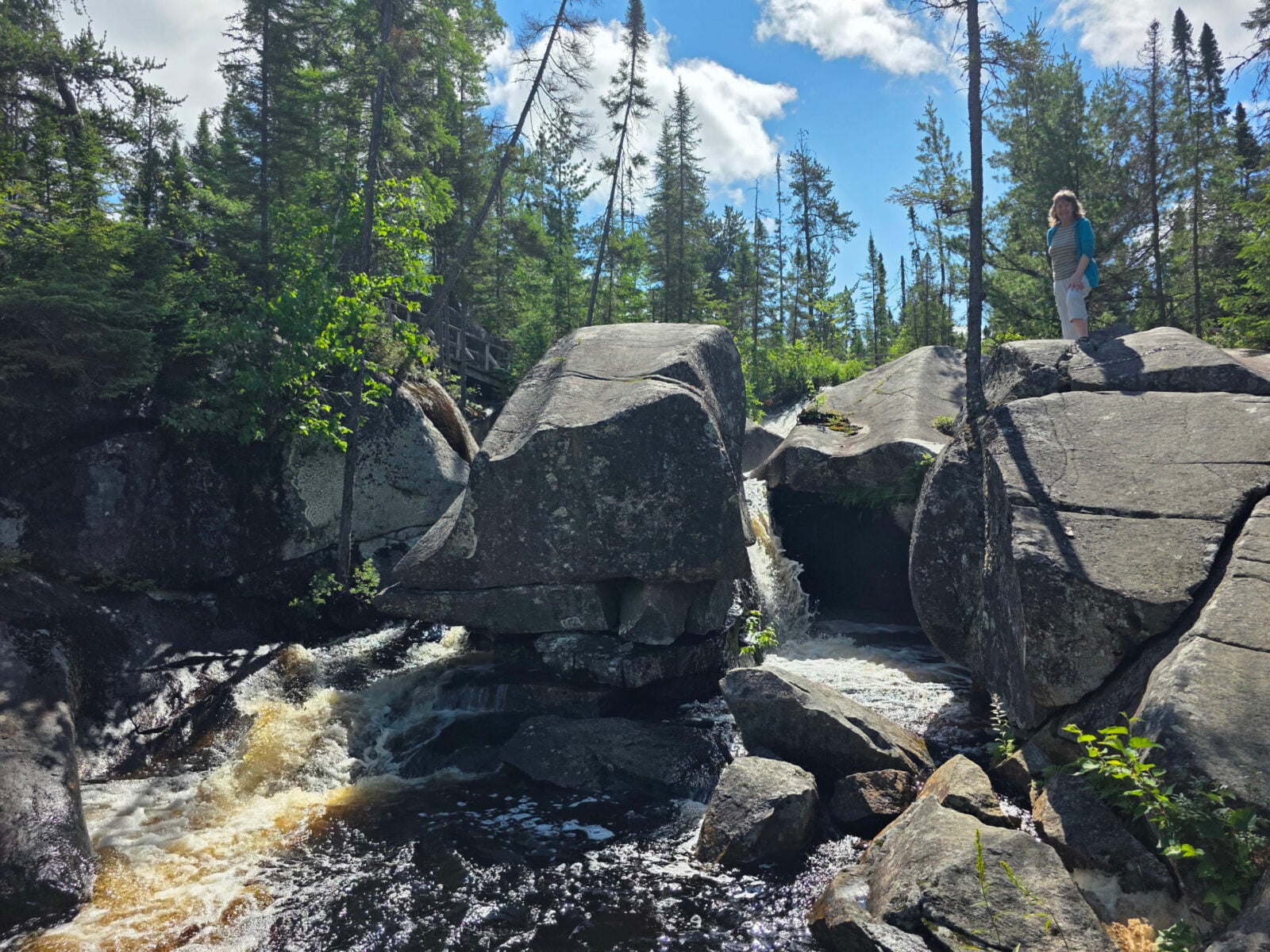
Our first stop was Potholes Provincial Park, an area set aside to preserve remarkable examples of erosion caused by glacial meltwaters on the granite bedrock. There is no camping in this park, but you can do a short hike to see the potholes carved in the Kinniwabi River. These potholes were much larger than the ones we see along the Bruce Trail in our area, and were more interesting as the water is still flowing through them.
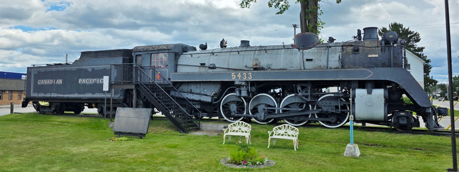
We decided to take a short detour to visit the town of Chapleau. It was a midway point on the train route from Sudbury to Lake Superior. We stopped at the visitor centre to see the locomotive that was placed there in August 1964. We toured the displays and then took the circular ramp road up and over the train tracks to access the local waterfront displays, where we had lunch in the park. The forest industry was and still is a huge part of the town.
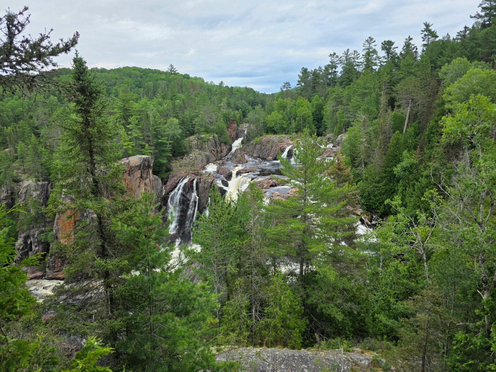
After lunch, we headed south and joined Highway 129 to complete the drive to Thessalon. This highway is called the Tail of the Dragon, and we would soon find out why. We had another stop we wanted to make, which was at Aubrey Falls, as they had another Group of Seven easel to see.
We were glad we didn’t encounter any cars on the way into the parking lot, as the gravel road was barely wide enough for one vehicle. The hike was approximately one kilometer long but had a significant elevation gain, and the forest was teeming with hungry mosquitoes. However, the view was worth it. There are hydroelectric dams that now control the flow, so we were fortunate to be there when the Mississagi River was in full flow. Tom Thomson painted “Northern River” when he was canoeing along this river.
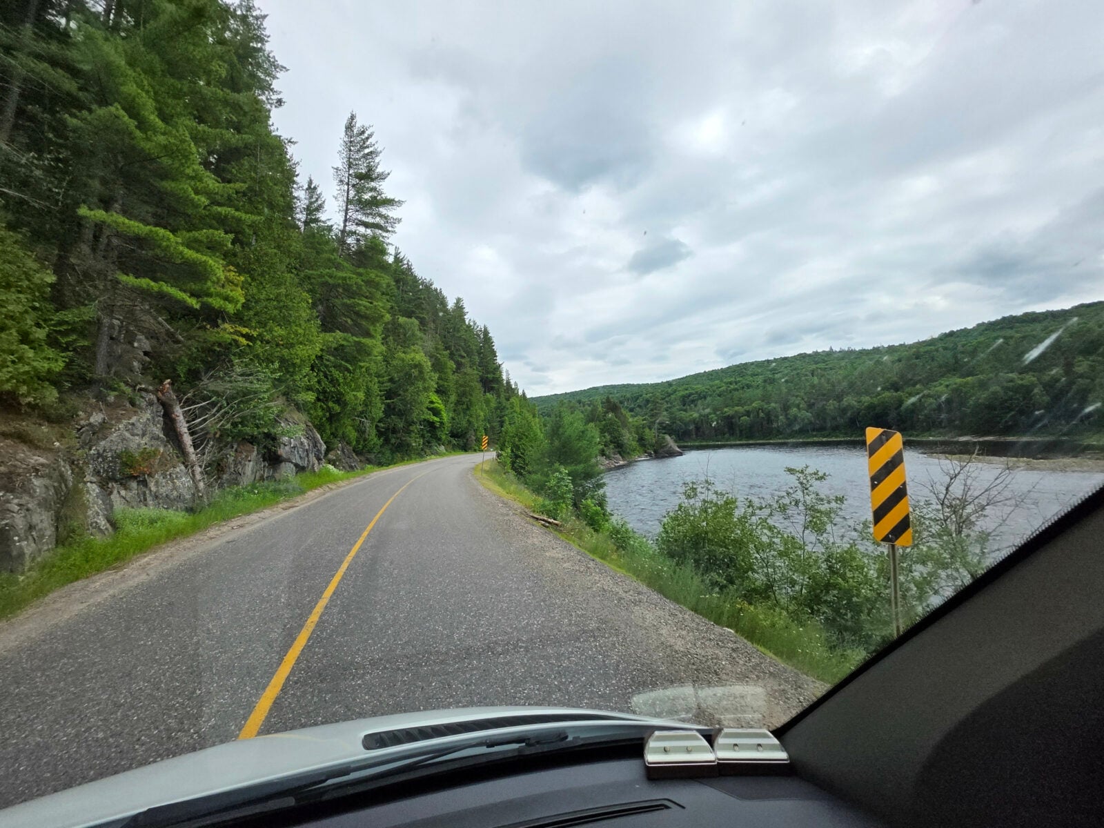
After Aubrey Falls, the road lived up to its name of Tail of the Dragon. You were driving along a narrow road right beside the river with a shoulder that would take you into the river if you hit it. The road was twisty, had lots of climbs and drops, and you had to dodge the potholes! It was very challenging to drive the RV. This same valley path is where the Algoma railway passes through in the fall, allowing people to view the fall colours in the forest. We stopped for a quick rest at the Tunnel Lake Trading Post, as they had mini dragon statues. We had survived another wild ride.
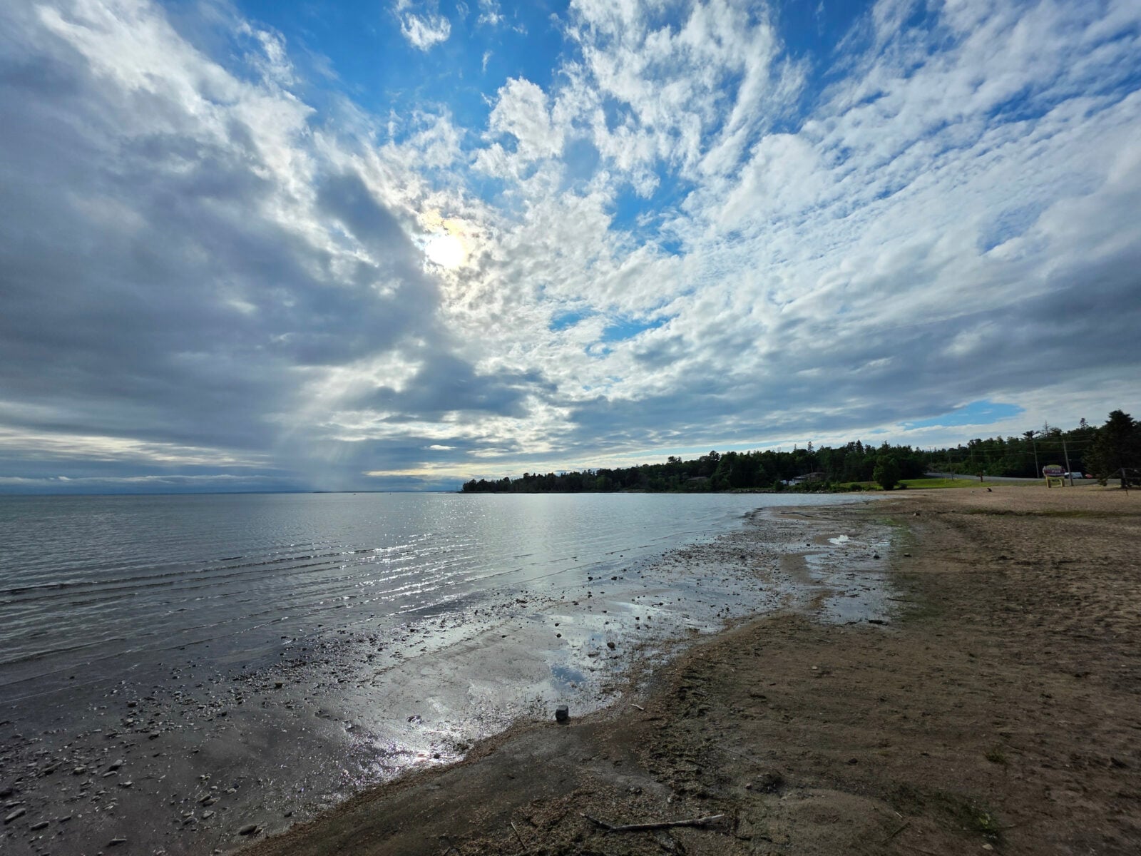
We arrived at Lakeside Park Community Campground and unfortunately did not have a very nice site. Luckily, this was only for 1 night, and we could walk across the street and walk along the beach with the North Channel right there. We had really just picked this park as it had a dump station, so we could clean out our tanks before returning home the next day.
I woke up very early the next day as our power went off at 6:00 am. I checked the pedestal, but the whole campground was off. Someone finally arrived at the campground around 7:45 am and got the power started again.
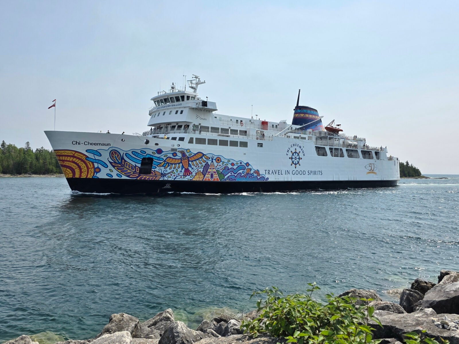
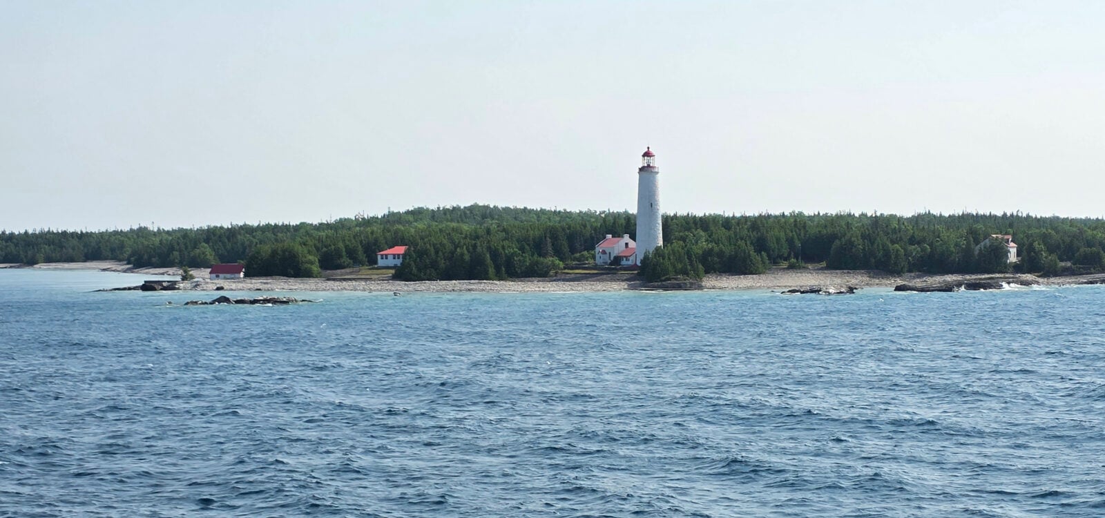
We got our tanks cleaned out and then started the long journey. We had a three-hour drive to South Baymouth to catch the ferry, we grabbed lunch in South Baymouth, the 2-hour ferry across to Tobermory, and then the 1-hour drive home. In South Baymouth, we had lunch at the Pierside Restaurant (I had fish & chips, and Sharon had the fish wrap), which was quite good, with excellent service. Even better, they had a stout beer from Split Rail Brewery that I hadn’t tried before. The ferry crossing was quite busy with a bit of chop due to the winds, but the blue sky and views of Cove Island just before Tobermory made it all worthwhile. The ferry saves the very long drive to Sudbury and around Georgian Bay.
This concludes our three-part series covering our one-month RV trip from home to Saskatchewan and back. If you would like to see a map of the entire 5,578 km journey, go to this link: RV Trip 13 Full Map. It also covered our 9th and 10th trips in the RV along the north shore of Lake Superior, and even with that many trips, we still found it possible to visit new places or have new experiences every single day.
What a perfect way to “Live for the journey, not the destination”.
Safe travels.
This is a companion discussion topic for the original entry at https://leisurevans.com/blog/ontario-to-saskatchewan-part-three/