
Editor’s Note: This post is written by a member of LTV’s sponsored content team, The Leisure Explorers. Do you own a Leisure Travel Van and enjoy writing? Learn more about joining the team.
The primary motivation for this RV trip was to head west from our home in Ontario to Regina, Saskatchewan, on July 5 for the Swenson family reunion. The reunion would celebrate the 100th anniversary of when Sharon’s dad’s family came from Sweden to Canada. Along the way there and back, we will visit a variety of parks and try to explore some new things. The way out was our ninth RV trip along the northern shore of Lake Superior, one of our favourite places to camp in Ontario. We decided to take our time, spending five nights and six days on the way out, staying at five different Ontario Provincial Parks.
Day One
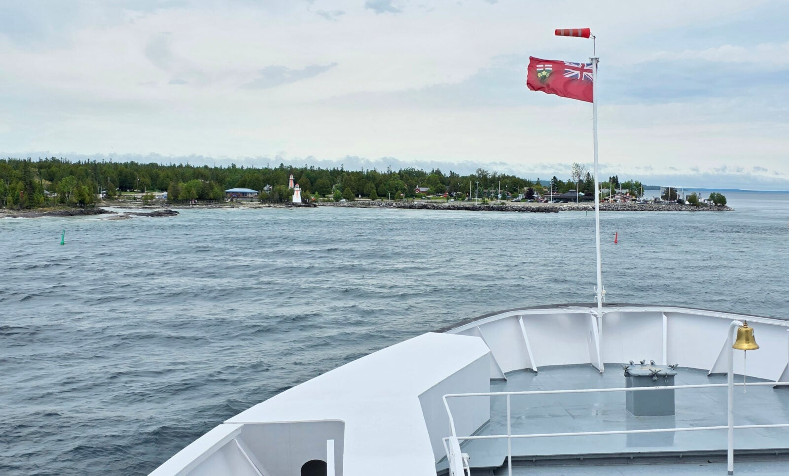
We travelled from our home to Tobermory so we could take the ferry across to Manitoulin Island. We arrived early in Tobermory so we could park in the ferry lanes and go to the Tobermory Brewing Company for an early lunch. I had the blackened salmon with a porter beer, Sharon had the fish tacos, and we shared the turtle cheesecake for dessert. After lunch, we returned to the RV at 12:30 pm, just as it began to pour with rain. Unfortunately, this also meant the first part of the ferry crossing (which is the most scenic) was foggy, rainy, and wavy. However, it was National Indigenous Peoples Day, and they had arranged for drummers, singers, and dancers to perform a show in the forward lounge, so we enjoyed that to pass the time.
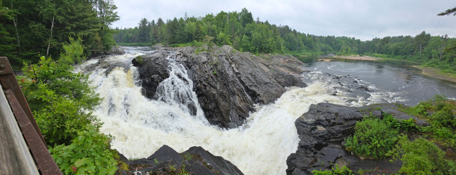
We drove through Manitoulin Island and exited the island across the Little Current Swing bridge. Our destination for the first night was Chutes Provincial Park, and just as we arrived, it started raining again. However, the rain stopped long enough for us to take a walk to see the waterfall. The waterfall got its name from the logging days, when logs would be brought down the river and across the waterfall to flow downstream. The mosquitoes were out after the rain, looking for fresh blood. Later, we realized this was the first time we’ve done the trip in June, and we hadn’t experienced mosquitoes on our other eight journeys. Typically, we’ve been travelling this route in August/September. We soon realized how different the bug situation is at this time of year!
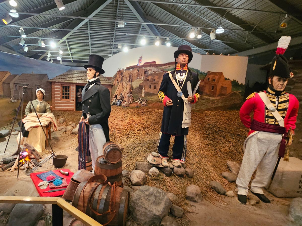
We decided to try to have at least one new experience each day on this trip west. The first one was to visit St. Joseph Island and the Fort St. Joseph National Historic Site. It’s roughly a 35-kilometer side trip one way to go to the Fort, and that had been why we hadn’t tried it in the past. However, our destination for that night was Pancake Bay Provincial Park, so we had the time to do this new stop. Fortunately, this summer, national parks and Historic Sites were free to visit, a bonus! This site had park staff in period costumes, a documentary about the history of the theatre, a museum, and the outside grounds where the foundations of many of the buildings were still there. Here are the key facts about this fort:
- The British withdrew from Michilimackinac in 1796, and then in 1797/1798, they built Fort St. Joseph with a blockhouse for troops, a bakehouse, a kitchen, a guardhouse, a powder magazine, a wharf, and lastly a wooden palisade. It was then the most westerly of the British Military posts.
- Officers of the Indian Department were also in the fort, and they held councils with the Indian allies.
- Eventually, a small community grew around the fort due to the protection it offered, but also the access for trading.
- The location was quite strategic as the main trading/shipping route for the voyageurs went along the Saint Mary’s River and Munuscong Lake right in front of the fort.
- After the US declared war in 1812, Captain Charles Roberts of Fort St. Joseph conducted a surprise raid on the Americans at Michilimackinac on July 17th, 1812, and they captured it without a shot being fired.
- Eventually, Fort St. Joseph was abandoned, and then in 1814, the Americans burned the fort down, and this is why there are only building foundations left.
- Parks Canada has conducted extensive archaeological surveys of the area, and in 1964, they discovered a Bateau that would have been used to transport limestone to the island for building foundations. It has been preserved and is now on display in the theatre.
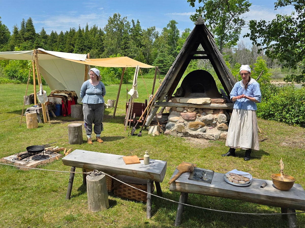
The displays in the museum were quite well done. After the museum, we took the trail out to the foundational remains of Fort St. Joseph. When we arrived at the demonstration area, they had just finished cleaning out the ashes from the bake oven as it had reached cooking temperature. The first thing the staff had baked was nutmeg biscuits, which were very good. Later, they were going to bake some bread. When we went to leave, they offered us some mud seed balls. They took clay and made it into a flat shape, mixed in some dirt, and then placed wildflower seeds in that dirt. Lastly, you formed it into a mud ball, and after it dries out, you can save it until you are ready to plant it. Sharon made a brand new one to give to her mom. Overall, this was an extremely interesting stop and well worth the extra 70-kilometer drive.
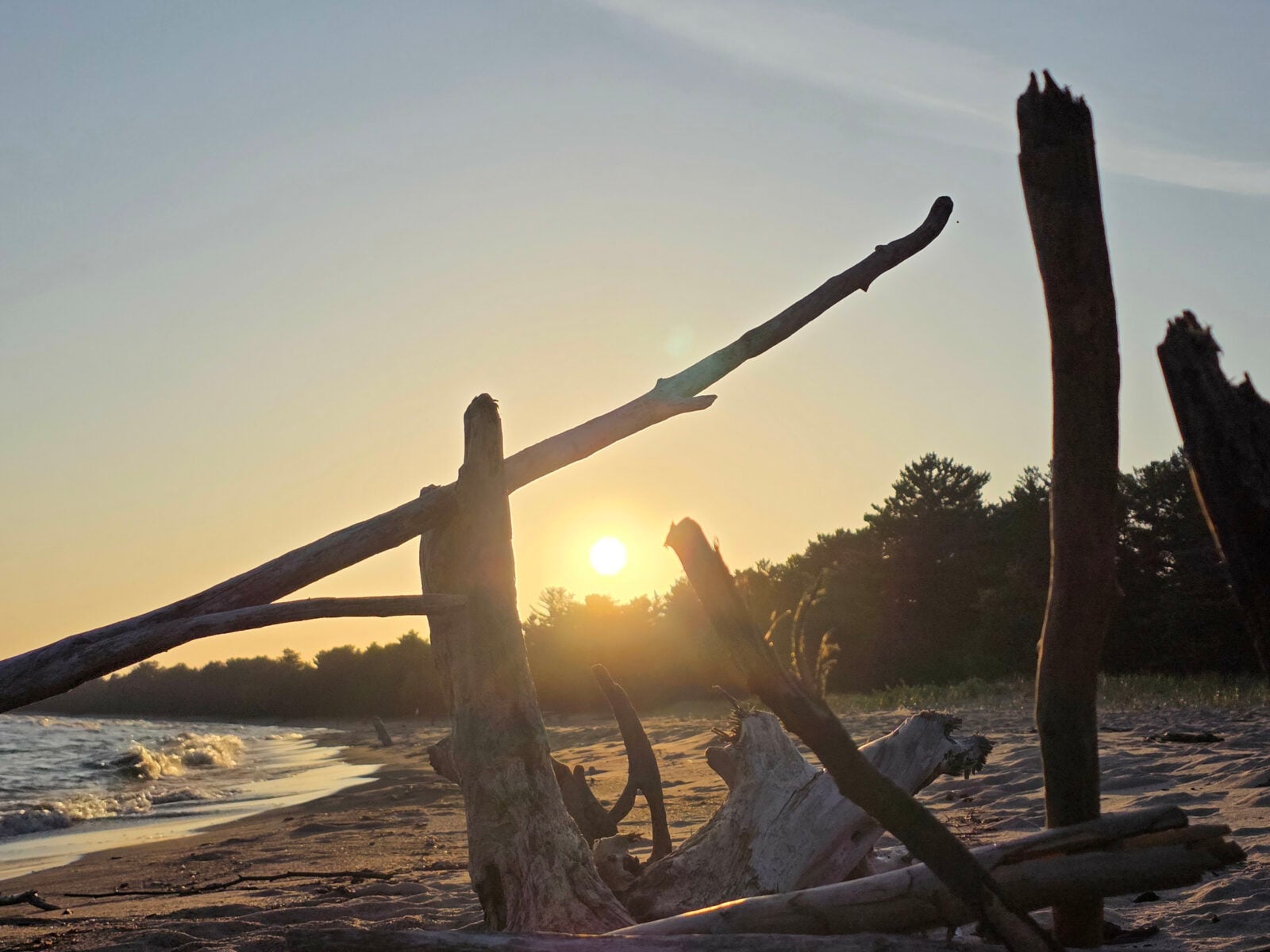
After Fort St. Joseph, we continued along the Trans-Canada Highway and found cheap diesel at an Esso station in Sault Ste. Marie (aka the Soo). We did some shopping in the Soo and then continued to Pancake Bay Provincial Park, where we had a beautiful campsite right across from the beach and Lake Superior. I had picked up some new water shoes in the Soo because we had forgotten to bring ours, so I had to check them out and go for a swim. The water was very calm, and it had been 34 degrees Celsius in the Soo, so the water was much warmer than when we went swimming in Georgian Bay at home. After we had dinner, we took a stroll on the beach and watched the sunset.
Day Two
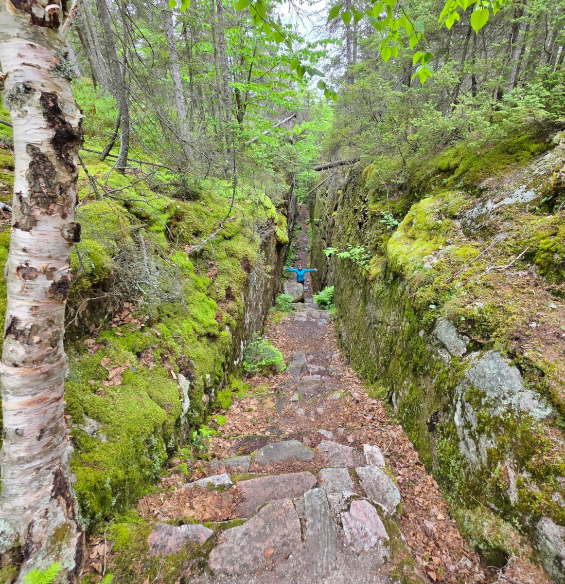
The next day was the beautiful drive through Lake Superior Provincial Park, and we decided to stop at the Agawa Rock Pictographs since we hadn’t been there in a while. There were only a couple of other people there, so the mosquitoes were anxious for their breakfast.
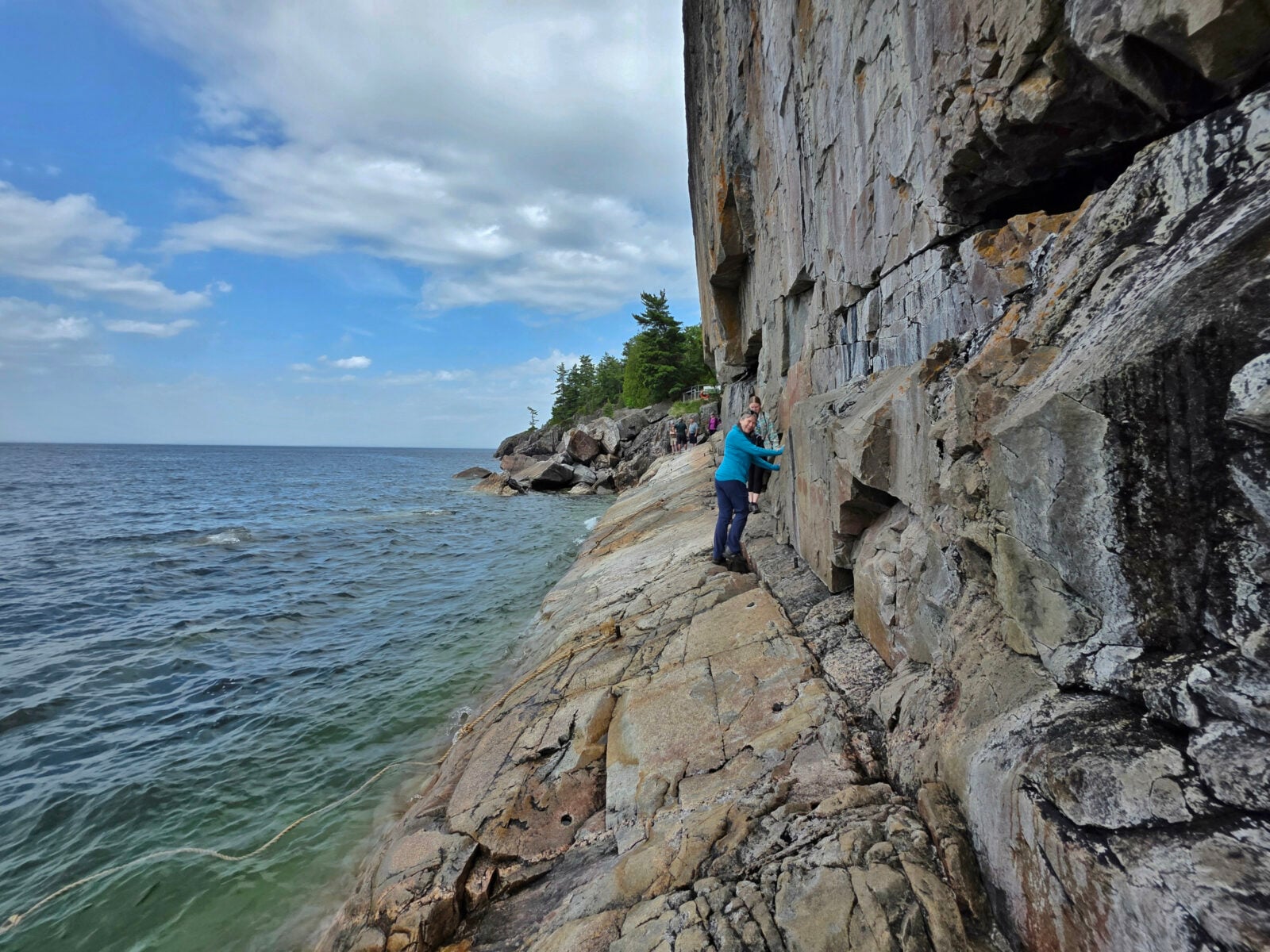
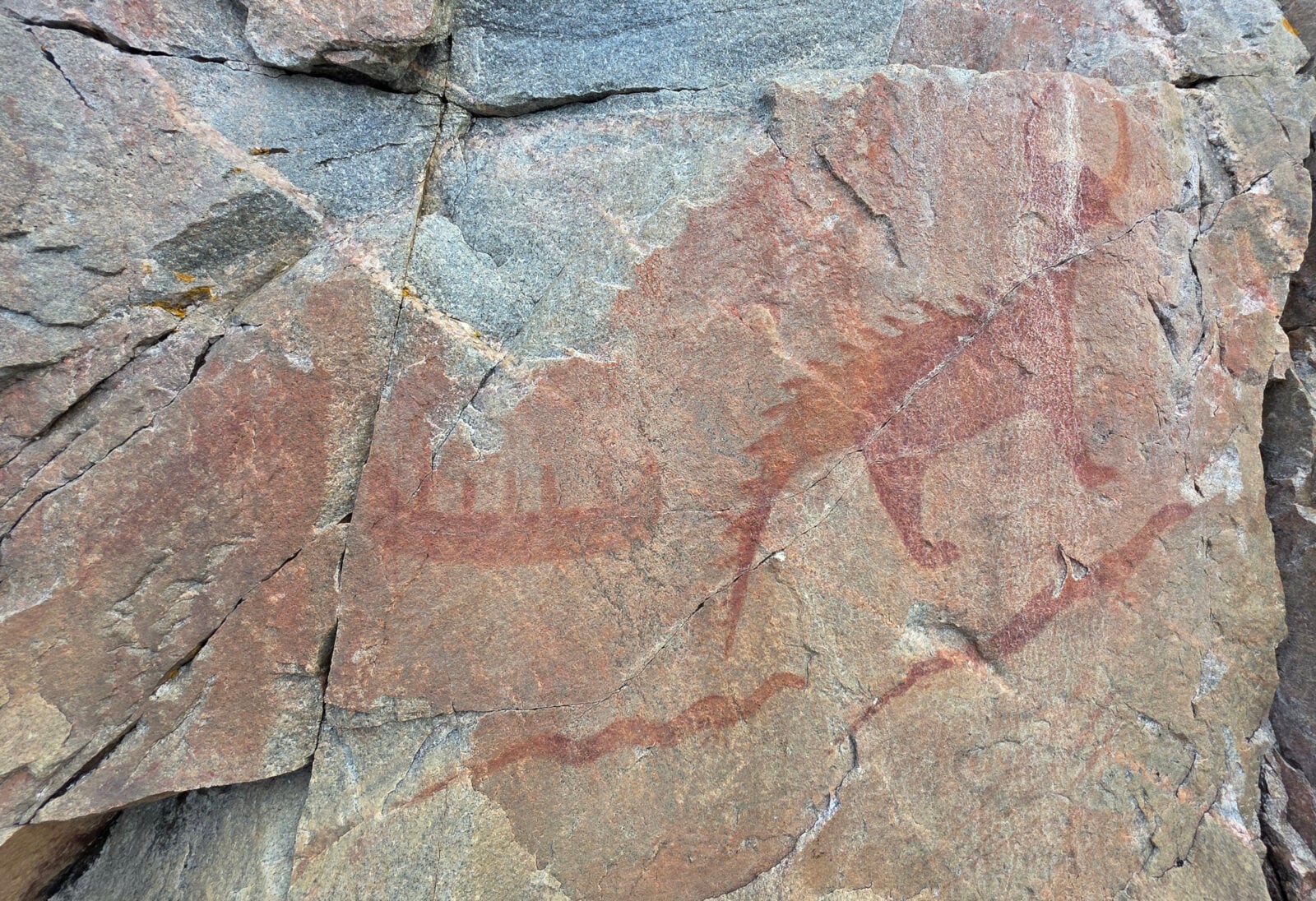
The hike is a short scenic loop through some rock crevasses until you reach the rock wall where the pictographs are located. The Ojibwe people created pictographs of mystical beings, animals, and humans, which are believed to be between 150 and 400 years old. You need a calm day to walk along the rock wall because the waves of Lake Superior can crash against its surface. They have some chains, ropes, and anchor pins to help you traverse the wall. We were able to see most of the pictographs without getting wet or slipping.
We were able to drive through the rest of Lake Superior Provincial Park before encountering very dense fog. The day before, we had 34 degrees Celsius in the Soo, and now our temperature has dropped to 13 degrees Celsius!
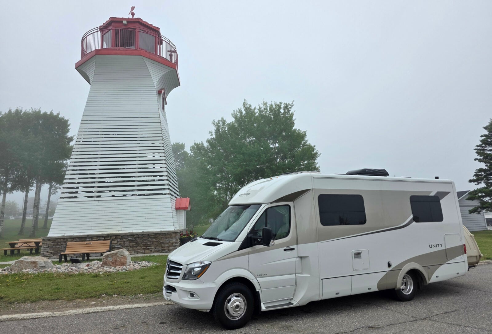
We stopped for lunch at a picnic spot just before Marathon, and it absolutely poured rain, but it stopped raining when we went to leave. When we reached Terrace Bay, we decided to see a new thing (to us), which was the lighthouse just off the main road. It is a 50-foot-tall replica of the lighthouse at Slate Islands Provincial Park, but we couldn’t see Lake Superior at all from the top due to the fog.
Our destination for the night was Rainbow Falls Provincial Park, Rossport Campground. If you want to dump your tanks, you need to do this first at the Whitesand Lake Campground; otherwise, you’ll have to do some backtracking. We couldn’t get one of the waterfront sites, but we did have a view of the lake. Additionally, another LTV was in the campground, so we spoke with them.
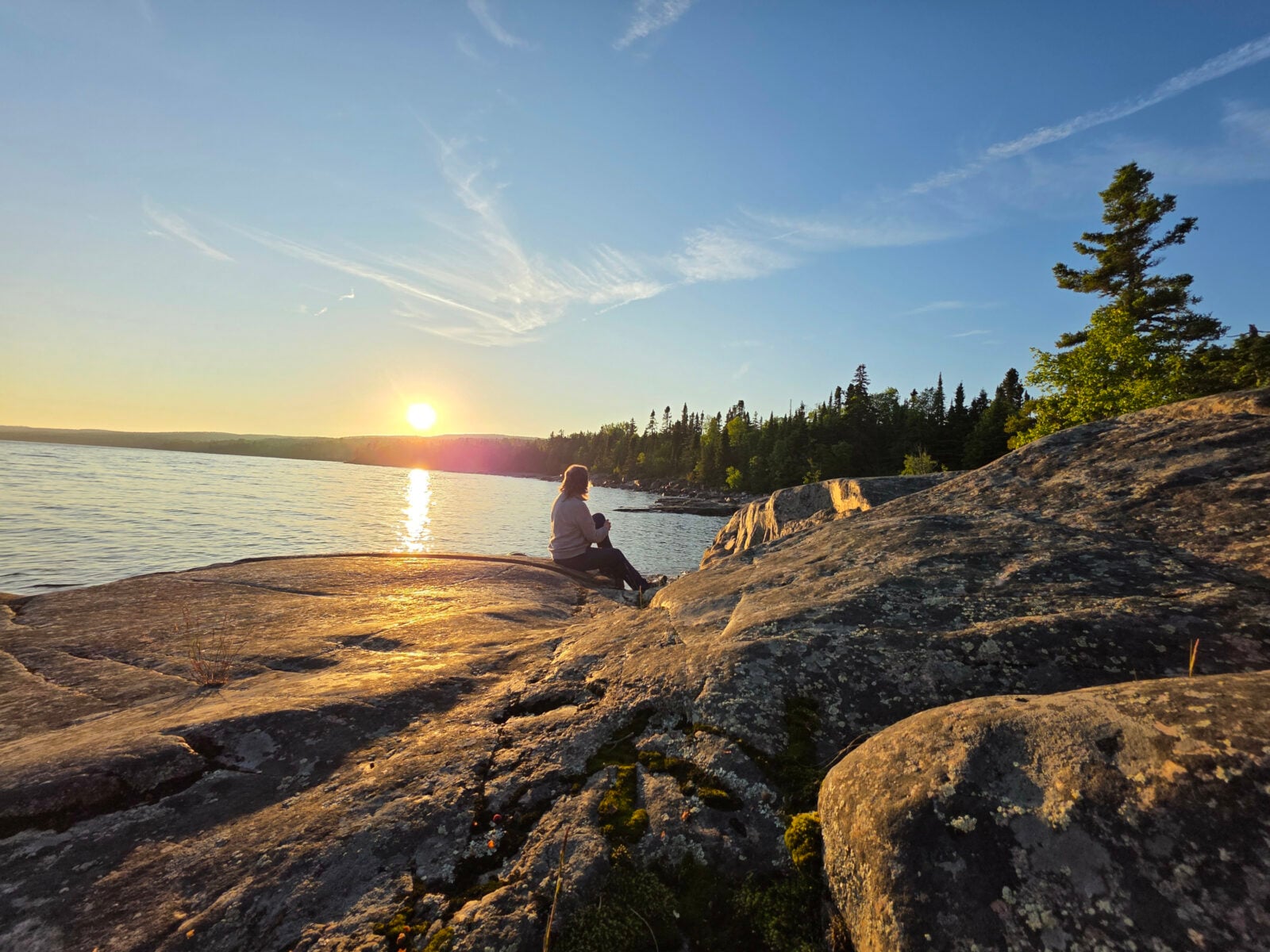
When we first set up, the black flies attacked with a vengeance! We had never experienced this at this park, as we had always camped in August/September. We took a stroll along the shores of Lake Superior and then returned to have BBQ’d steaks for dinner. After dinner, we found a nice spot along the rocky shore to watch the sunset, another very nice one, which we often see from this park.
Day Three
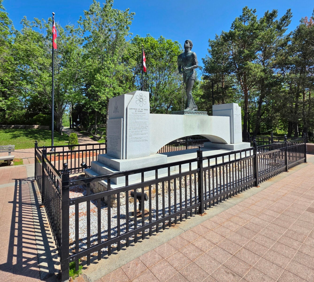
The drive the next day was totally clear. We crossed the Nipigon bridge, and further north, we came across the Terry Fox National Ride of Hope on their cross-Canada ride. When we arrived at the Terry Fox National Historic Site, we realized we had just missed greeting them the day before, as they had held a ceremony at the monument. We have participated in the Terry Fox run for 44 of the 45 years.
We took the Thunder Bay bypass and headed to Quetico Provincial Park, where we arrived before the 2:00 pm check-in, as we had crossed the time zone line from Eastern Time to Central Time.
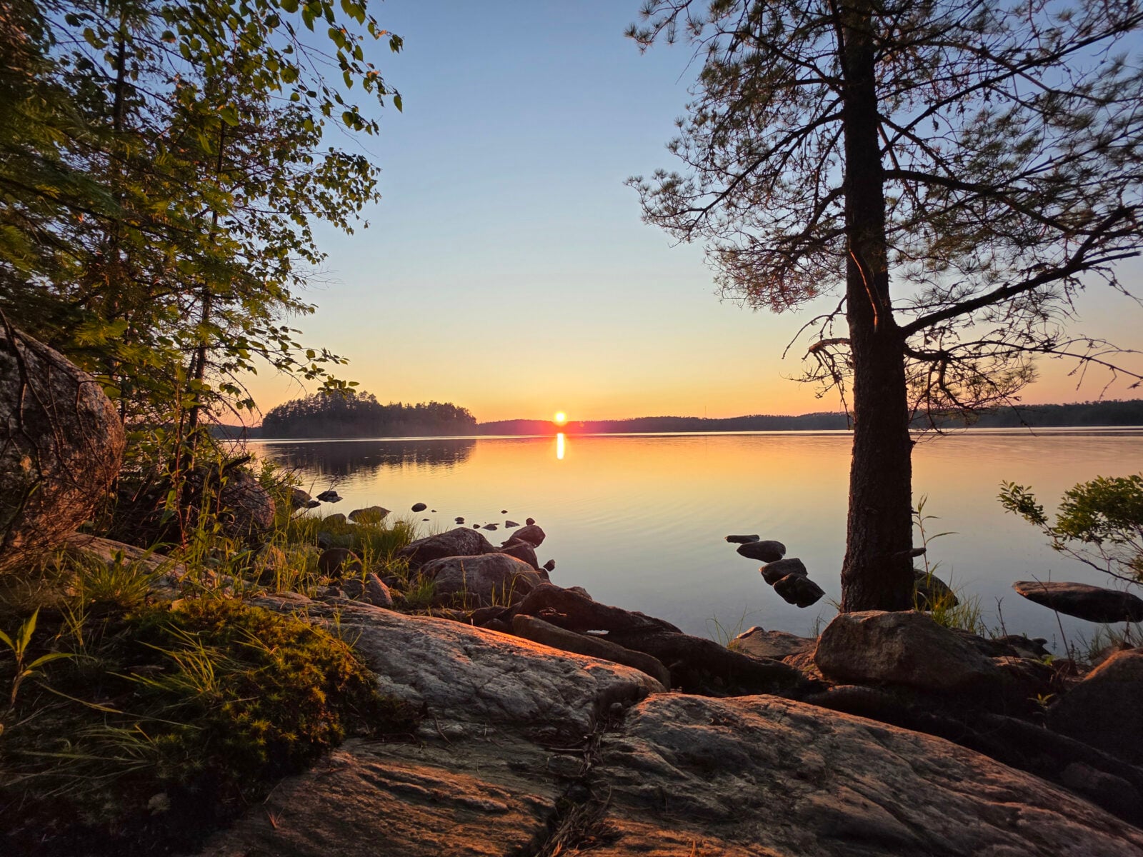
At our campsite, we discovered that the electric outlet was not functioning, although the neighbour’s outlet in the same post was working. We called the office, and they sent maintenance people to look at it, but they couldn’t resolve the issue. We plugged into the neighbour’s outlet since they hadn’t arrived yet. Since we had one of our favourite sites, we really didn’t want to move to another one. The park manager came by and was very apologetic about the issue, offering to reimburse us for the cost of electricity and provide us with free firewood. However, when the neighbours did show up, they didn’t have the 100-feet of electric cord necessary to connect to the pedestal (standard issue in Ontario Provincial Parks), so we got to stay plugged in to their slot, and then they got the credit for the electricity. We realized later that the free firewood was not properly dried, so we spent three hours tending to our smoke fest. However, the sunset more than made up for it.
There was very little traffic on the Highway 11 southern route the next day, except for logging trucks. We decided to stop for lunch in Fort Frances and went to La Place Rendez-Vous since it was right along the water. They seemed to be well underway with a massive renovation and had a brand-new composite deck right along the water. Most people seemed to be eating inside, but we chose the waterside.
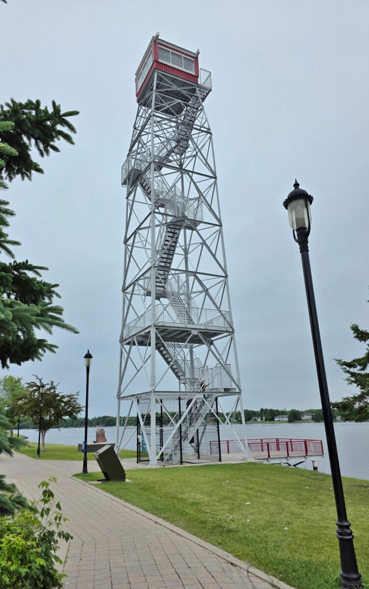
The main road through Fort Frances was under construction, and when we followed the detour route, we discovered some other new things we hadn’t seen before. There was a 100-foot lookout tower that was initially part of the Early Radar Detection system as a defense mechanism during the Cold War. They also had some signboards explaining the history of logging, pulp, and paper in Fort Frances. Lastly, there was a signboard about the North-West Mounted Police when they went through Fort Frances in October 1873. Sharon’s Dad had been involved in the setup of a commemorative statue in Fort Dufferin near Emerson, Manitoba, for the March West.
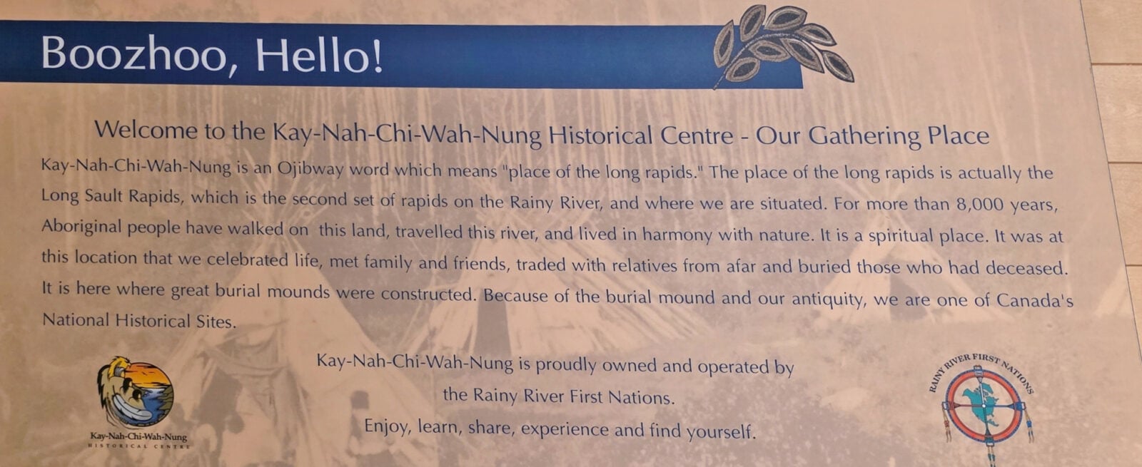
When we left Fort Frances, we decided to do a 40-kilometer detour to see the Manitou Mounds National Historic Site – Kay-Nah-Chi-Wah-Nung (Manitou Mounds), one of the most spiritually and archaeologically significant places in Canada.
- It has the largest concentration of burial mounds in Canada, dating back 800 to 2000 years.
- It is a cultural and spiritual hub for the Indigenous peoples across North America, also known as “The Place of the Long Rapids”.
- It was designated a National Historic Site in 1969.
After travelling down the dirt roads, we arrived at the Interpretive Center, where they house over 16,000 artifacts. We looked around the displays as we waited for our guided tour out to the mounds. In the exhibits we learned about:
- The story of Mother Earth from the Mishomis Book.
- About the Waaginogaan dome-shaped tree bark structures.
- How they grew and harvested wild rice.
- The importance of sturgeon fish to the people of the area when they came to this location in the spring and fall.
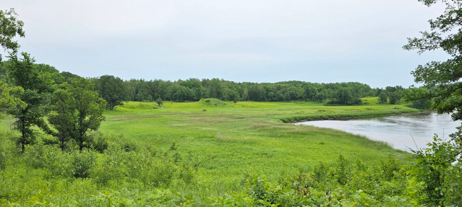
Eventually, our guide was ready to take us on the golf cart out to the mounds. You could walk the 5-kilometer out and 5-kilometer back, but the trail was just through the bush with little to see along the way. Additionally, there were very few interpretive signs, so it was best to have the guide explain things along the entire route and at the mounds.
Our first stop was to see the Round House and the Cottage. A local had owned the land and recognized the importance of the mounds, so he preserved the area. Eventually, his descendants gifted the land to the Rainy River Band. They also purchased some other land around the main section of mounds from a settler who had partially destroyed one of the mounds. When an Indigenous person passed away, they would wrap the body in an animal fur until the body decomposed, and then they would bundle up the remaining bones and place them in one of the mounds.
At one point, there were 23 mounds on the site; 15 remain today, and 8 of those are visible from the tour. The fields around the mounds were beautiful with wildflowers and the biggest lady slipper flowers we’d ever seen. The white pelicans migrate through this area, and we saw four in the river. The guide told us they feed on the baby sturgeon fish. The Rainy River band has been trying to preserve the Sturgeon fish population, so they raise and release hatchlings. Sturgeon are considered a threatened species in Canada, so regulations are stricter on the Canadian side of the river. Before we left the mound area, the guide offered to do a tobacco ceremony, where she said a prayer and then released tobacco back to the earth.
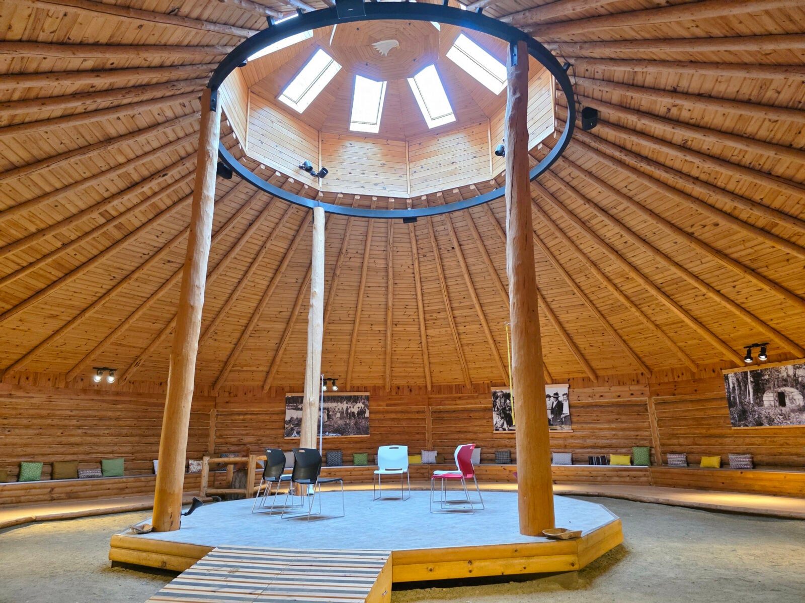
On our return trip, we stopped in the round house to look inside. They hold communal gatherings in the round house and have pictures of the guide’s ancestors. She was a descendant of the Chief who signed the original Treaty 3 in this area. Once back at the center, Sharon went to the restaurant to buy a takeaway portion of the wild rice soup and some Bannock so we could try that later. Again, this was another worthwhile detour from the normal route.
We were the last to leave the centre as it was just before 5:00 pm closing time. The good thing is that we didn’t have anyone coming down the dirt road towards us, as it was pretty narrow and would have been difficult to pass a vehicle coming the other way.
We still had 170 kilometers to travel to reach our final destination, Rushing River Provincial Park. It was a pretty drive through Nestor Falls and Sioux Narrows. When we arrived, the park office was closed, so we proceeded to our reserved site. The site wasn’t very level, so it took some time to balance out the leveling blocks on the front wheels, but we did have a good view of the lake. After dinner, we took a walk around the North campground section we were in, and it was surprising how full it was; we guessed that it was because schools had finished that day and the Canada Day long weekend was approaching.
Day Four
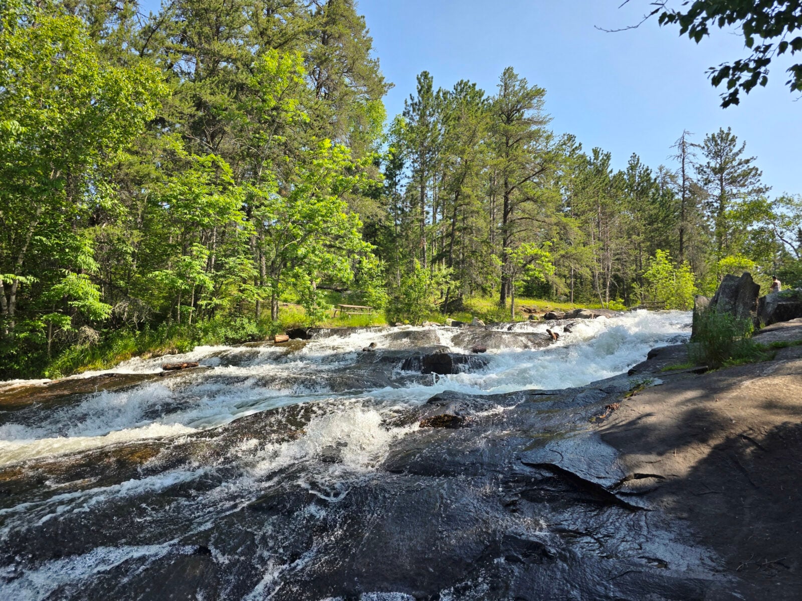
The next morning, when we left, we dumped our tanks and then spent some time looking at the waterfalls along the Rushing River. It seemed like much more water than we had seen in the past.
As we carried on into Manitoba, we wanted to stop at our favourite cheese factory, Bothwell, but first we tried a new restaurant called Grandpa’s Café in Blumenort. It seemed quite bizarre to find a Mexican restaurant in this area, but we enjoyed the jalapeno margaritas and the fish and shrimp tacos. The cheese factory outlet was low on stock, but we were still able to buy enough cheese to last the rest of the trip.
That concludes Part One of our RV trip from Ontario to Saskatchewan. The key takeaway is that your journey isn’t just about reaching the destination; it’s about discovering new paths, hidden wonders, and unexpected lessons and learnings along the way. Part two of this trip will cover the journey from Manitoba to Saskatchewan and return.
This is a companion discussion topic for the original entry at https://leisurevans.com/blog/ontario-to-saskatchewan-part-one/